With a few days off from teaching, I lit out for Gubbio just after dawn, but struck holiday traffic on the outskirts of Bologna. A five hour trip stretched to eight, giving me ample time to nibble on a frisbee-sized disc of rest stop Mortadella, and admire a beautiful train - five blue subway cars on holiday from the city? - skip through the wheat fields. On the radio, American pop. On the autostrada, Fiats, Audis and campers jostled towards the coast.
Gubbio is inland, on the road to Rome if you’ve come ashore on the Adriatic somewhere south of Venice. I’d convinced the GPS to bring me directly to where I thought the K-T boundary site was, a kilometer or so north of town along a steep winding road. I’d read about it on some geology blogs (rock on!) and there was apparently a sign marking the spot. Passing through Gubbio, a medieval town with an array of Roman ruins, I slowed to a geological crawl and admired the relentless recklessness of the Italian motorists who pulled past on what would likely be a one-lane road in my home country.
At last I saw the tell-tale yellow sign. Victory! There was nowhere to pull off, so I parked next to a dumpster and hoofed it back downhill alongside the terrifying speedbikes tearing towards town. My yellow sign looked like it had survived a few collisions with said bikers, but it still proudly proclaimed that this was a Scientific Site of Global Relevance. Trouble was, where was the site? The area around the sign was a tangle of weeds and slugs and mud, each layer of roadside rock blending uninterestingly into the next. The local highway department had even slathered cement here and there to give purchase to a metal net that kept rocks off the road. Was this it? I swore a bit. Eight hours! There were two shrines nearby, marking the sites where motorists had been killed around the time I’d been born. I stopped swearing and took a few pictures. A snail watched me from within his shell.
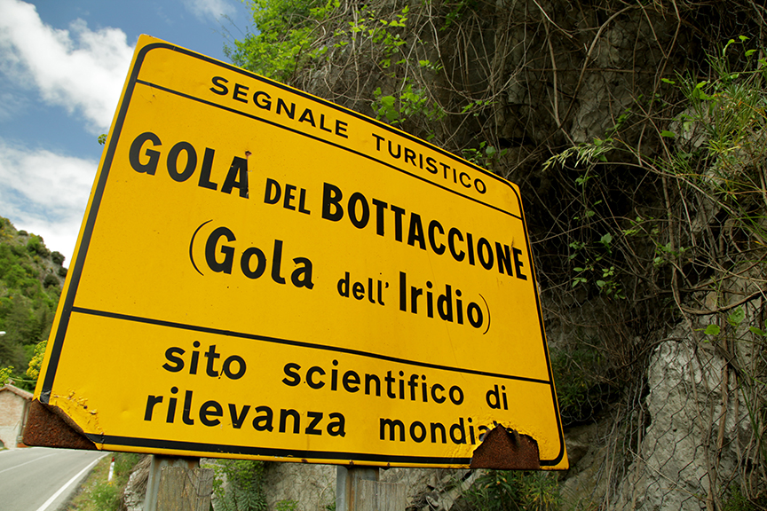
Scientific Site of Global Relevance!
Resolving to salvage my roadtrip with a Gubbian Gelato, I pointed my rental car uphill a few hundred meters to find a turnaround spot — and that’s when I saw the layer. Another bedraggled sign, a small gravel pull-off, aha! I was so elated, it was as if I, not Walter Alvarez et al, had discovered the reason the dinosaurs went extinct.
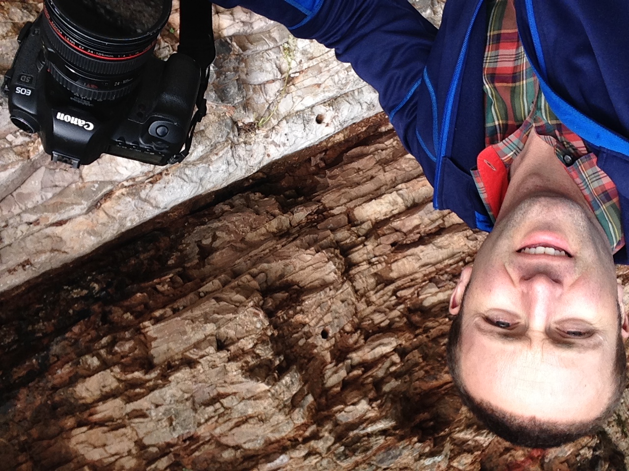
Quintessential K-T selfie.

K-T boundary (folks have scooped out most of the clay) between dinosaur times (Cretaceous) and, well, after.
In 1980, while I was busy working my way out of my mother’s womb, a geologist named Walter Alvarez and his Nobel Prize-winning father figured out why the dinosaurs kicked their various buckets. The key (for the Alvarez crew) was a layer of reddish clay sandwiched between two layers of limestone, each representing a distinct geological time period: the Cretaceous (K) and the subsequent Tertiary (T). (FYI, we’re now supposed to call the Tertiary the Paleogene, making this the K-Pg boundary. Noted!) The clay contained abnormally high concentrations of iridium, an element found only rarely on this planet’s crust, but in larger concentrations in asteroids.
Well, in retrospect it seems simple, but it took a while for the Alvarez team to convince folks of their theory of what happened 65 million years ago. Asteroid hits the Yucatan, dust and sulfur fill the sky and acidify the water, many creatures die. A layer of iridium-rich detritus covers the land. Earth marches on. Mammals inherit Earth. Romans build Gubbio. Italians blast a road cut. Walter samples the rock layers. Ian walks to Gubbio and buys a gelato.

Gelato, 65 million years after K-T Extinction Event.
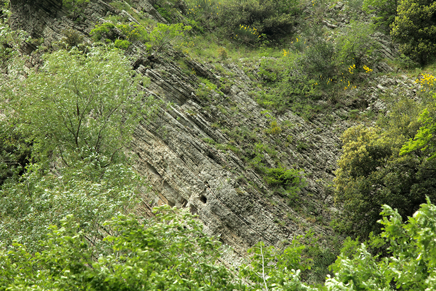
With chocolate, arachide and fiordilatte gelato, I wandered back up towards the iridium layer to have another look. Each layer of rock was only a few inches thick, but represented thousands or even millions of years of history, compressed. I stood there staring at it, desperate for geological comprehension. It's among the most elusive comprehensions on earth, up there with love, death and astronomy. Each little layer is time and space compressed. Everything from a vast stretch of time compressed into a layer the size of a panini. I thought about taking everything in my life - say, my childhood home, the telescope I built in high school, the woods along the frozen stream where I first stepped through the ice, all the cities and cafés and hotel lobbies I’ve wandered into, the National Air and Space Museum with the plaque dedicated to my grandfather, the 1980-2014 Boston Red Sox squads, my wife, my salad bowl, me - and pressing us all into a layer of rock no thicker than, say, a slice of rest stop Mortadella. Incomprehensible. All human civilization, eventually compressed into a layer of rock. Unacceptable! Humans have no business looking at iridium layers.
Insupportable!
A few feet above these rocks, I noticed a beautiful stone wall stretching along the steep escarpment. An aqueduct built by the Romans. It snaked up the valley to an overgrown dam filled with green water. There, I stopped for a while and listened to Italian frogs bellowing and burping, presumably for mating purposes. Motorbikes screamed by. The water trickled along through the broken dam. Everything and everyone was headed downhill, so I followed suit, back to town where le signore were putting out flags to celebrate the country’s unification after World War II, and a man hung out a sign proclaiming the Roman ruins closed until Tuesday.